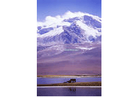
Himalayas, situated at the south edge
of Qinghai-Tibet Plateau, range from Pamir Plateau in the west to the great turning
point of Yarlung Zangbo River in the east. The mountains span over 2,450 km long
from east to west, and 200 - 300 km wide from south to north, with an average altitude
of 6,200 m.
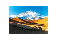
Himalayas, the most imposing and the highest mountain range in the world, are made
up of several roughly parallel branch ranges. From north to south, they are Big
Himalayas, Small Himalayas, Siwalk Hills, etc. Big Himalayas, main branch range
of Himalayas, boast 40 peaks over 7,000 m high. Mount Qomolangma, at an altitude
of 8,844.43 m, is the highest mount in the world. Located on the border of China
and Nepal, it dominates the middle of Himalayas like a majestic pyramid and is called
third polar of the world.
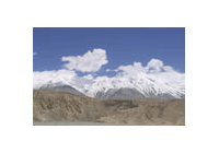
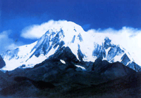
Emerged only several hundred thousand years ago, Himalayas are the youngest mountain
on the earth. Nowaday they are still growing!
Do you know?
Himalayas in Tibetan language means "land of snow". All the peaks over 7,000 are
snow-capped all year round and glaciers can be found everywhere.
Next